
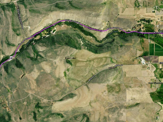
Paris Canyon Trail head for snowmobiling, ATV riding, hiking, horse riding, dirt bike and mountain biking. ATV & Recreation Trails: View our ArcGIS interactive map. Snowmobile Map: Idaho State Parks Snowmobile Trail Map with Grooming Info
View more
Trailhead for snowmobiling, ATV riding, hiking, horse riding and mountain biking between Lava Hot Springs and Pocatello. ATV & Recreation Trails: View our ArcGIS interactive map. Snowmobile Map: Idaho State Parks Snowmobile Trail Map with Grooming Info
View more
Weston Canyon Trailhead for snowmobiling, ATV riding, hiking, horse riding, dirt bike and mountain biking. Connects to trails leading to Malad. ATV & Recreation Trails: View our ArcGIS interactive map. Snowmobile Map: Idaho State Parks Snowmobile Trail Map with Grooming Info
View more
Find easy access to one of four trailheads on the Caribou Loop in southeastern Idaho or western Wyoming. Explore 200 scenic miles of trail on the Caribou Loop Trail and terrainfor all types of riders.. View the Caribou Loop Trail ArcGIS interactive map.
View more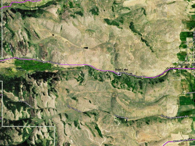
Bear Lake Idaho area Trailhead for snowmobiling, ATV riding, hiking, horse riding, dirt bike and mountain biking. ATV & Recreation Trails: View our ArcGIS interactive map. Snowmobile Map: Idaho State Parks Snowmobile Trail Map with Grooming Info
View more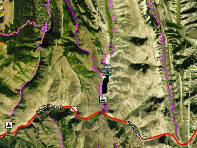
Crow Creek trail head near Montpelier Idaho offers snowmobiling, ATV riding and mountain biking. ATV & Recreation Trails: View our ArcGIS interactive map. Snowmobile Map: Idaho State Parks Snowmobile Trail Map with Grooming Info
View more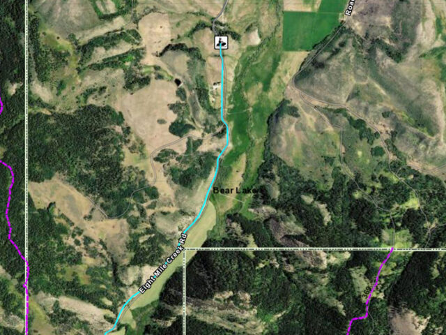
Eight Mile Trail Head for snowmobiling, ATV riding, hiking, horse riding and mountain biking. ATV & Recreation Trails: View our ArcGIS interactive map. Snowmobile Map: Idaho State Parks Snowmobile Trail Map with Grooming Info
View more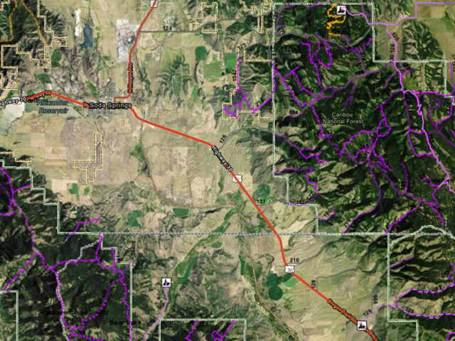
Trail Canyon near Soda Springs has more than 250 square miles of trails on forest service land through scenic forested mountains and onto powdery valley floors.
View more
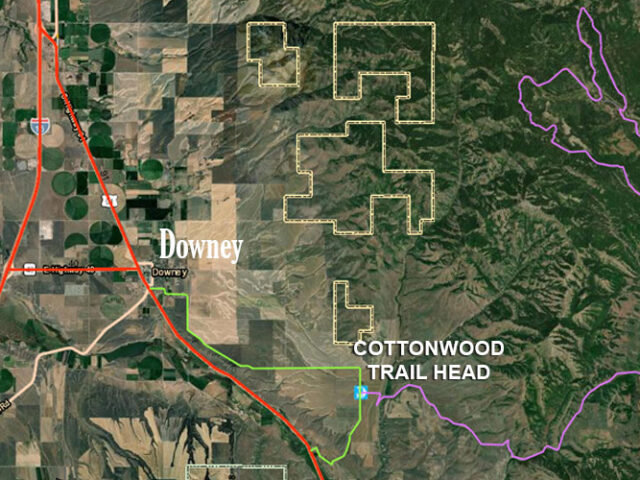
Downey area trailhead for snowmobiling and ATV riding. Plowed parking area. Access from Downey or Back Red Rock Road. Get directions. SNOWMOBILING: View Idaho Parks & Recreation’s FREE Interactive Southeast Idaho Snowmobile Trail Map on EVTRAILS with real-time grooming information! Zoom into the area you are interested in, click the trail…
View more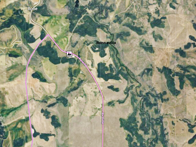
Trailhead for snowmobiling, ATV riding and mountain biking.
View more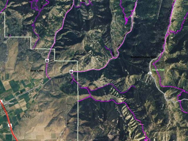
Georgetown area trailhead for snowmobiling, ATV riding and mountain biking near Bear Lake and Montpelier Idaho. ATV & Recreation Trails: View our ArcGIS interactive map. Snowmobile Map: Idaho State Parks Snowmobile Trail Map with Grooming Info
View more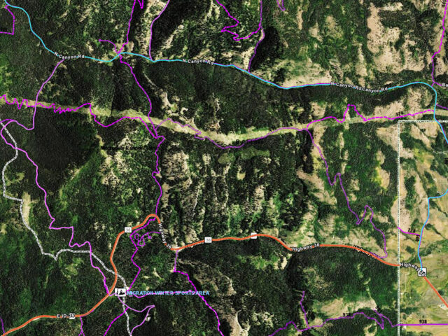
North Canyon Trail Head near Montpelier Idaho is great for snowmobiling, ATV riding, hiking, horse riding, dirt bike and mountain biking. ATV & Recreation Trails: View our ArcGIS interactive map. Snowmobile Map: Idaho State Parks Snowmobile Trail Map with Grooming Info
View more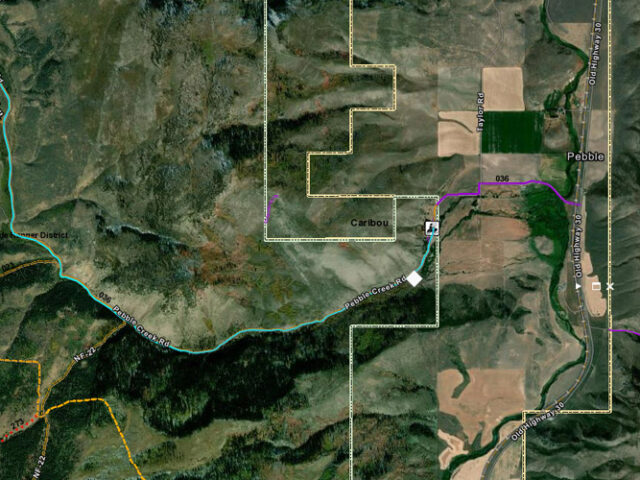
Pebble Creek Trailhead for snowmobiling, ATV riding and mountain biking, horse riding and hiking north of Lava Hot Springs Idaho. View our ArcGIS Map of the Pebble Creek Trail Montpelier Ranger District322 North 4th StreetMontpelier, Idaho 83254(208) 847-0375
View more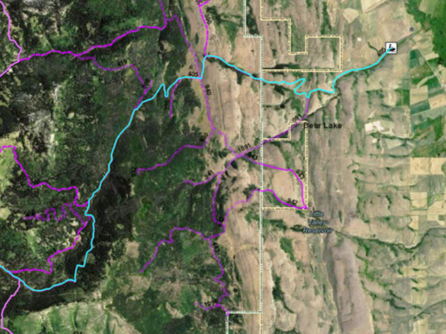
Mill Farm Road trailhead for snowmobiling, ATV riding and mountain biking near Bear Lake Idaho. ATV & Recreation Trails: View our ArcGIS interactive map. Snowmobile Map: Idaho State Parks Snowmobile Trail Map with Grooming Info
View more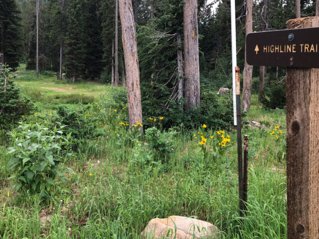
Highline is a 55-mile trail mostly at 9000 feet elevation between Preston and Soda Springs. It is suitable for both hikers and bikers as well as Cross Country skiing or snowshoeing in the winter. Contact the Montpelier Ranger District for maps and information. ATV & Recreation Trails: View our ArcGIS…
View more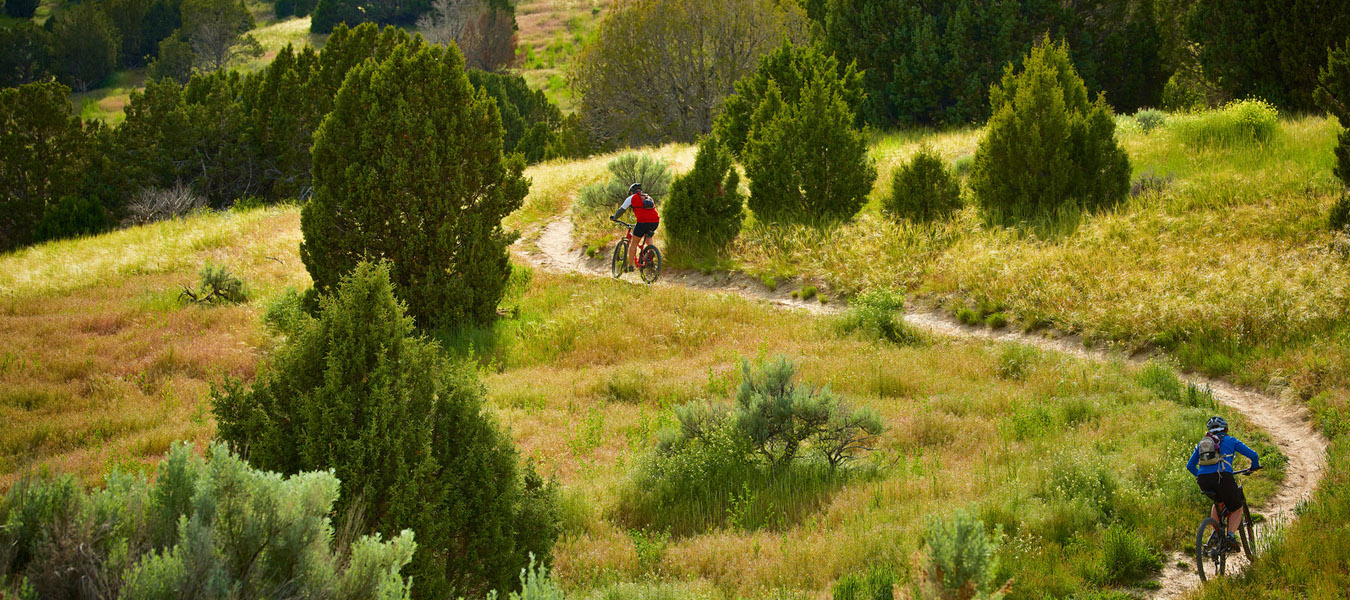
The hills and mountains around Pocatello Idaho are covered with mountain bike trails. Terrain ranges from mild jeep roads to technical single tracks for abilities of all levels. Trails include Trail Creek & Howard Mountain Area, City Creek, Kinport Mountain, and Cusick Creek, Slate Mountain, Valve House, Corral Creek, Porcelain…
View more
Trailhead for snowmobiling, ATV riding, horse riding, dirt bike and mountain biking near Soda Springs Idaho. ATV & Recreation Trails: View our ArcGIS interactive map. Snowmobile Map: Idaho State Parks Snowmobile Trail Map with Grooming Info Trail Canyon Nordic Trail View our interactive ArcGIS Ski Trail Map. US Forest Service…
View more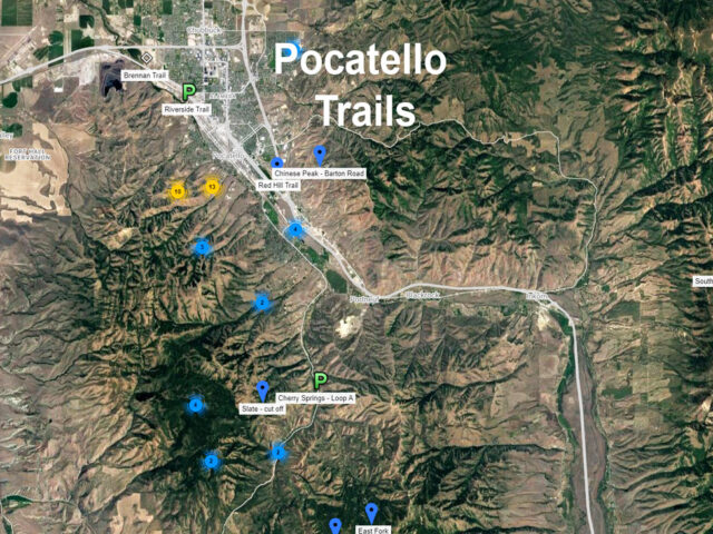
Summer Trails: Explore over a thousand miles of recreational trails and greenway paths in the Pocatello area. There is an exhilarating trail for every hiker, biker, ATV rider and horse rider in Bannock County! Winter Trails: The Bannock County grooming program maintains 250 miles of snowmobile trails including the Inman/Pebble/Toponce…
View more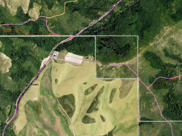
Pocatello area trail head for snowmobiling, ATV riding, hiking, horse riding, dirt bike and mountain biking. ATV & Recreation Trails: View our ArcGIS interactive map. Snowmobile Map: Idaho State Parks Snowmobile Trail Map with Grooming Info More maps on Visit Pocatello Trails page.
View more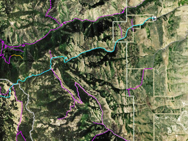
Green Canyon Trail Head for snowmobiling, ATV, horse riding, hiking and mountain biking near Bear Lake. ATV & Recreation Trails: View our ArcGIS interactive map. Snowmobile Map: Idaho State Parks Snowmobile Trail Map with Grooming Info
View more
Trails in the City Creek Management Area cover all possible ability levels. Bikers ride from march to November. Runners and hikers hit the trails year round. Beginners can cruise rim trail, bench and bail for a warm up to the terrain. 52 miles of single track and several motorized routes…
View more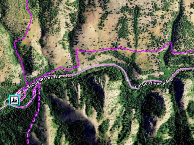
Trailhead for snowmobiling, ATV riding and mountain biking.
View more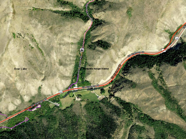
Montpelier Idaho area Trailhead for snowmobiling, ATV riding and dirt biking, mountain biking and horse riding. ATV & Recreation Trails: View our ArcGIS interactive map. Snowmobile Map: Idaho State Parks Snowmobile Trail Map with Grooming Info
View more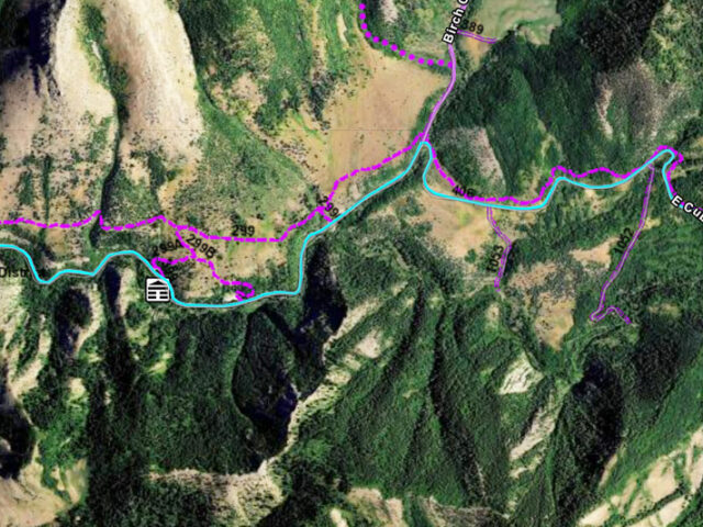
Cub River snowmobile trails sport over 350 miles of groomed trails to get you into the greatest high country snow this side of winter. Thousands of acres of great snowmobiling include Cub River Canyon, Paris Meadows, Midnight Mountain, Green Basin. Summer offers hiking, biking and ATV trails.View our ArcGIS interactive…
View more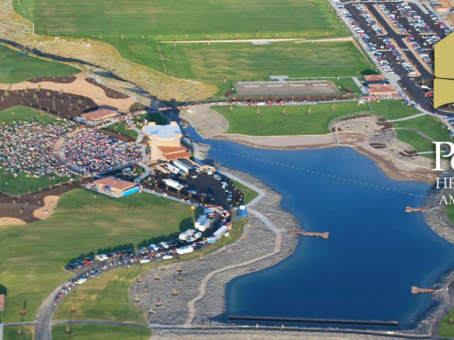
Family sports park in Pocatello. There is a 7-acre lake with a swimming beach with fishing access. There is mountain bike park and a large children's playground. It has multi-use sports fields, basketball courts and a sand volleyball pit. A state-of-the-art amphitheater hosts local events as well as big concerts, festivals and community…
View more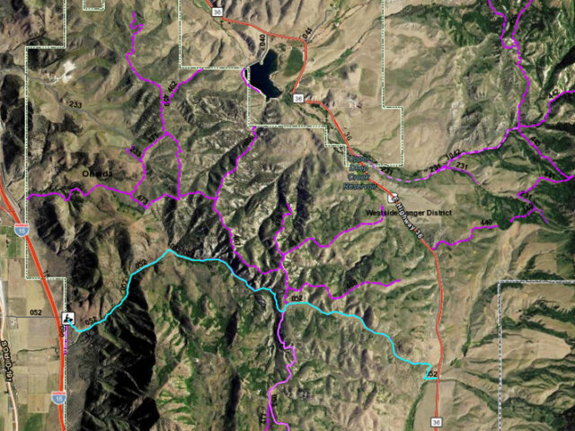
Snowmobile trails course across hundreds of miles of wide open space as they lead travelers through this snowy valley or onto groomed trails along mountain ridges and rolling hills. This winter area, located on the Idaho-Utah border is easily accessible from Interstate 15 with services available in Malad. Summer offers…
View more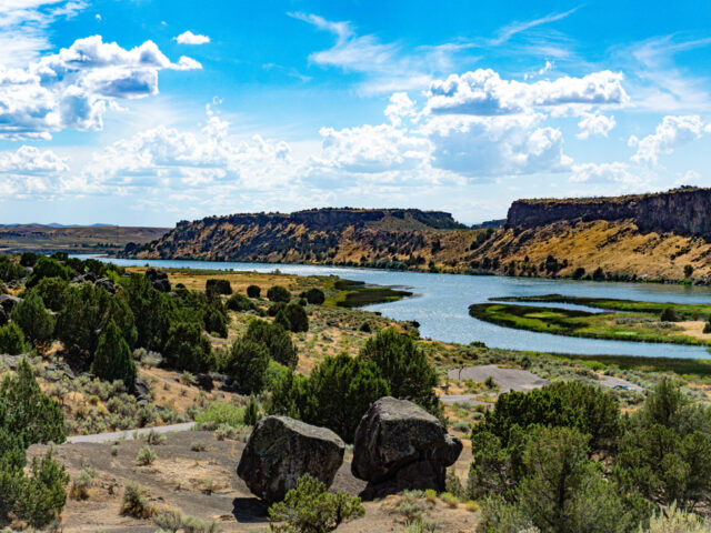
Massacre Rocks State Park is one of the Historical Areas operated by the State of Idaho to remind visitors of the march of history through the state. Ten miles west of American Falls on I-86, take exit 28 and follow the signs. The park has stories to tell which date…
View more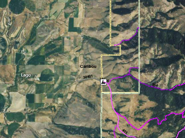
Grace Idaho Trailhead for snowmobiling, ATV riding and mountain biking. ATV & Recreation Trails: View our ArcGIS interactive map. Snowmobile Map: Idaho State Parks Snowmobile Trail Map with Grooming Info
View more
Trailhead near Preston Idaho for snowmobiling, ATV riding, horse riding, dirt biking and mountain biking. ATV & Recreation Trails: View our ArcGIS interactive map. Snowmobile Map: Idaho State Parks Snowmobile Trail Map with Grooming Info
View more
Scout Mountain near Pocatello provides nature trails and campsites for snowmobiling, ATVs, hiking, biking and horseback riding. Scout Mountain Campground is located just 13 miles south of Pocatello, Idaho. It is a great place for birding and wildlife viewing.ATV & Recreation Trails: View our ArcGIS interactive map. Snowmobile Map: Idaho…
View more
Hike or bike up the main trail to the ruins of the old Molydbenun Mine or hike to the “L” on the side of the mountain. The whole way offers stunning views of Lava and the river. The lower part of the trail was developed by Lions club in 1990….
View more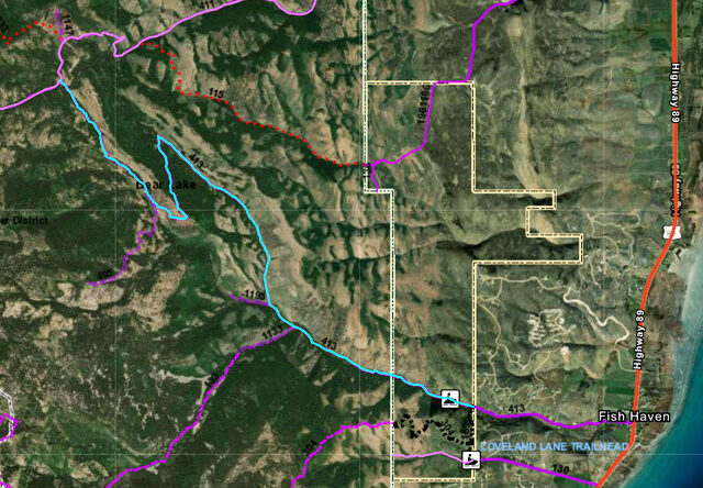
Summer and Winter trail head above Fish Haven near Bear Lake for snowmobiling, ATV riding, hiking and mountain biking. ATV & Recreation Trails: View our ArcGis interactive map. Snowmobile Map: Idaho State Parks Snowmobile Trail Map with Grooming Info Montpelier Ranger District 322 North 4th Street Montpelier, Idaho 83254 (208)…
View more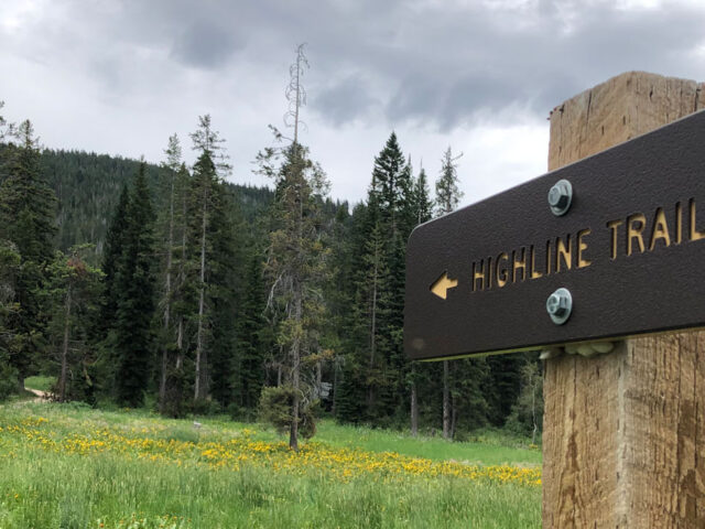
The Caribou National Forest was created in 1907 by President Theodore Roosevelt. Recently the administration was merged with the Targhee National Forest. Combined, the two forests now cover more than 2.8 million acres and thousands of miles of trails in southeastern and eastern Idaho, with small portions in Utah and…
View more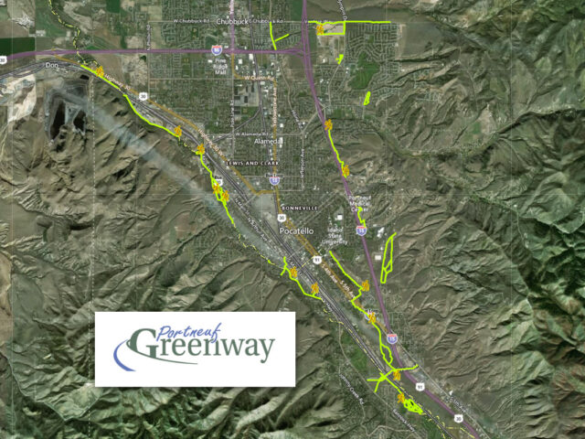
The Portneuf Greenway features miles of paved beautiful walking and biking trails. They run along the Portneuf River, inside Ross Park and on the ISU campus. Most of our trails are ADA accessible. View our ArcGis interactive trail map. Birding: View Blackchinned Hummingbird, Swainson’s and Redtailed Hawk, Wilson’s Snipe, Sandhill…
View more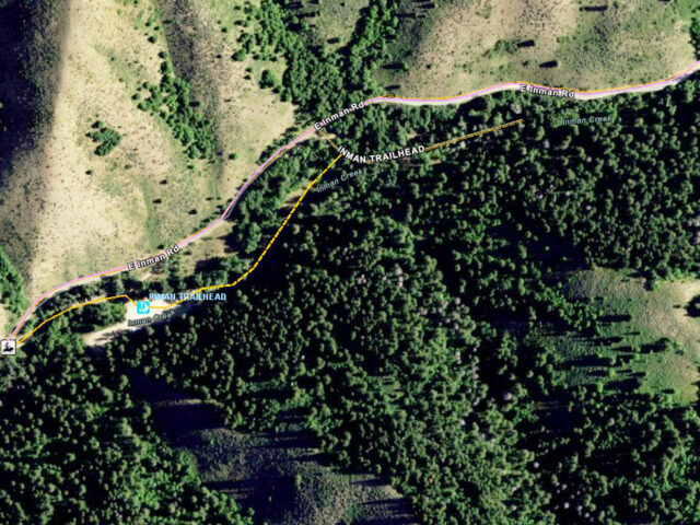
Trailhead for snowmobiling, Cross Country skiing, ATV riding and mountain biking.
View more
Beautiful Bear Lake Valley has a network of over 350 miles of groomed trails and has extensive additional mileage in marked, ungroomed trails. Changes in elevation offer terrains varying from mountainous to open meadow. Montpelier, Bloomington, Fish Haven and St. Charles have great trails. The St. Charles-Fish Haven Loop is…
View more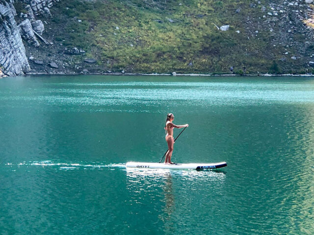
This small remote lake is located at the top of the mountain in a spectacular setting. Enjoy beautiful scenery of wildflowers, huge cliffs and 2 lakes. Bloomington Lake is a high elevation glacial lake with great trout fishing! The last one-quarter mile is limited to foot travel only. Trailhead opens…
View more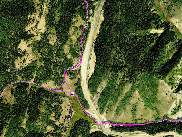
Montpelier Idaho area Trailhead for snowmobiling, ATV riding and dirt biking, mountain biking and horse riding near Bear Lake Idaho. ATV & Recreation Trails: View our ArcGIS interactive map. Snowmobile Map: Idaho State Parks Snowmobile Trail Map with Grooming Info
View more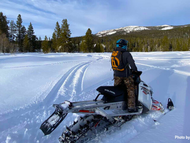
Snowmobile trails near Lava Hot Springs often feature spectacular views of Mt. Bonneville and the Portneuf River area near the town. Warm up in Lava's hot pools after a day of fun! ATV & Recreation Trails: View our ArcGIS interactive map. Snowmobile Map: Idaho State Parks Snowmobile Trail Map with…
View more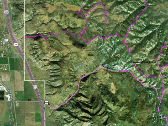
Trail head for snowmobiling, ATV riding and mountain biking near Malad Idaho.
View more