
Sheep Rock was the location of the first split of the Oregon-California Trail. The Bidwell-Bartleson Party and the Hudspeth Cutoff diverged from the main trail here. Oregon Trail Public Park and Marina – This park, on the shore of Alexander Reservoir, features a marina, picnic area and playground, and a remnant of the Oregon Trail.
View more
This forested area offers public-lands-campground, recreation and wildlife viewing in the great outdoors of the Caribou-Targhee National Forest.
View more
This site is the point on the Bear River where water was first diverted by Mormon settlers to develop an agriculture industry in Gem Valley. It was completed in the early 1900's and was an engineering masterpiece for it's time. The Last Chance Canal Company was started with 64 original…
View more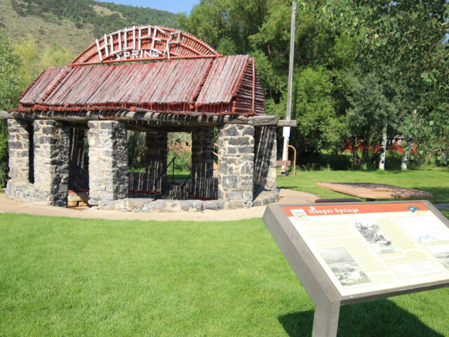
Free, clear sparkling soda water still is available in a beautiful Soda Springs city park located two miles north from the center of town. A prime attraction for more than 160 years, soda water from these springs was known nationally after rail service reached this resort area in 1882. W.H….
View more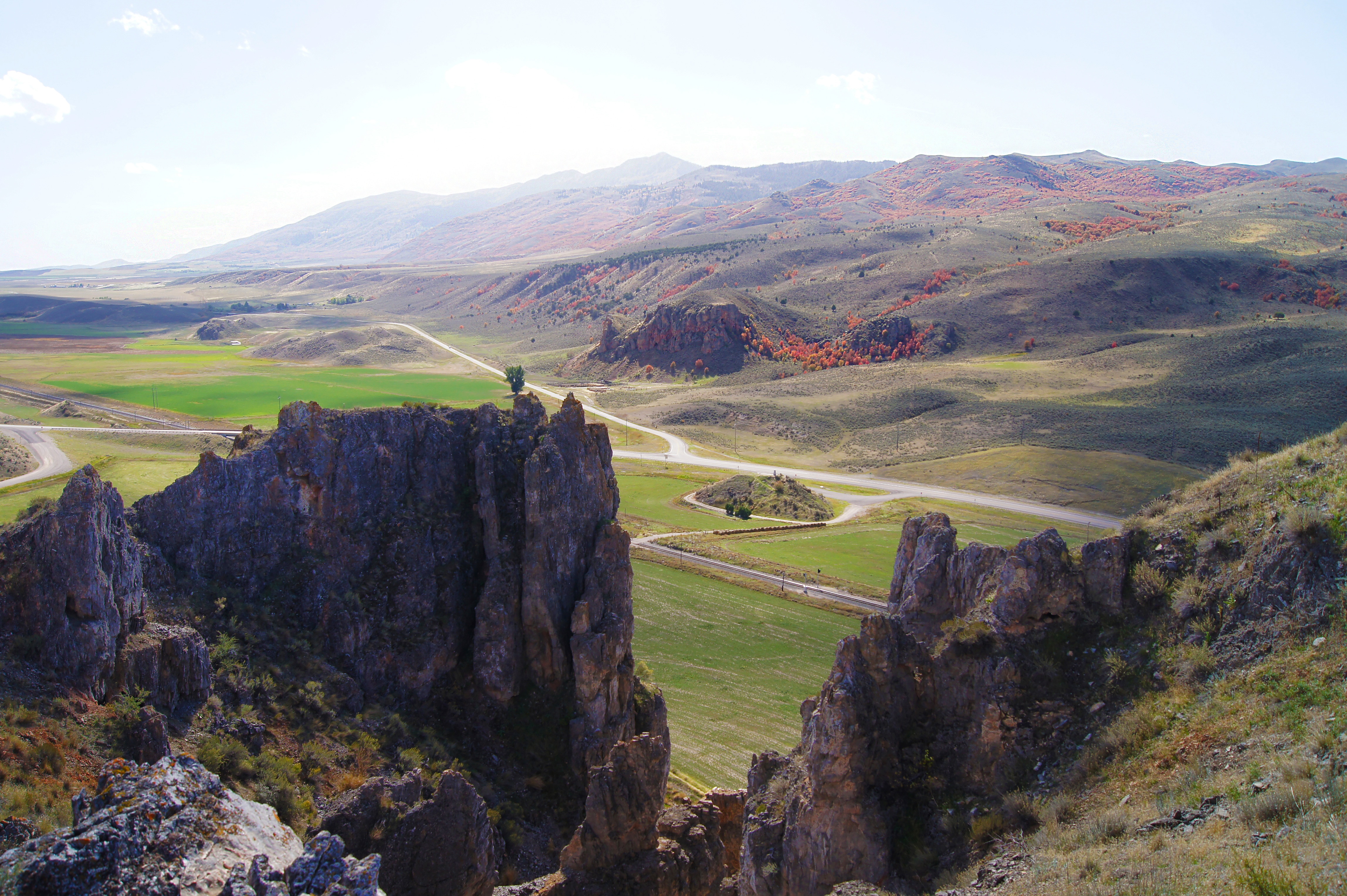
Red Rock Pass was cut through a sill of resistant Paleozoic shale, limestone, and dolomite, and forms a narrow gap two miles long. At one time the pass was at the shoreline of Pleistocene Lake Bonneville, 300 feet higher. Lava flows in the vicinity of Pocatello diverted the Bear River through Lake Thatcher into Lake Bonneville.
View more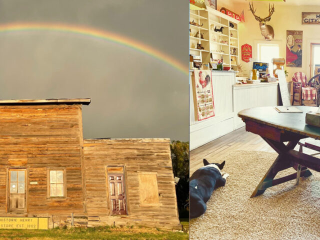
This store was built in 1908 and is a last remnant of a small but important livestock community in that time. The once famous Henry Stampede Rodeo and Stockman's Reunion began here in 1918. This mercantile store played an important role in the history of this place, and today, the…
View more
In 1989, 160-acres surrounding Formation Springs was turned into a preserve established by the Nature Conservancy to protect the crystal clear pools and unique wetland complex. The water feeding these terraced pools is very high in travertine (calcium carbonate), which has created a unique geology for the area, the most impressive…
View more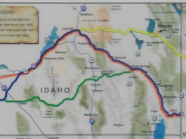
The site is a 7 mile segment of "The Lander Cut-off of the Oregon Trail", the first road commissioned by Congress with funding for location and construction. F.W. Lander supervised the project.The highway on the way to Grays Lake is following the Lander Cutoff of the Oregon Trail, and offers…
View more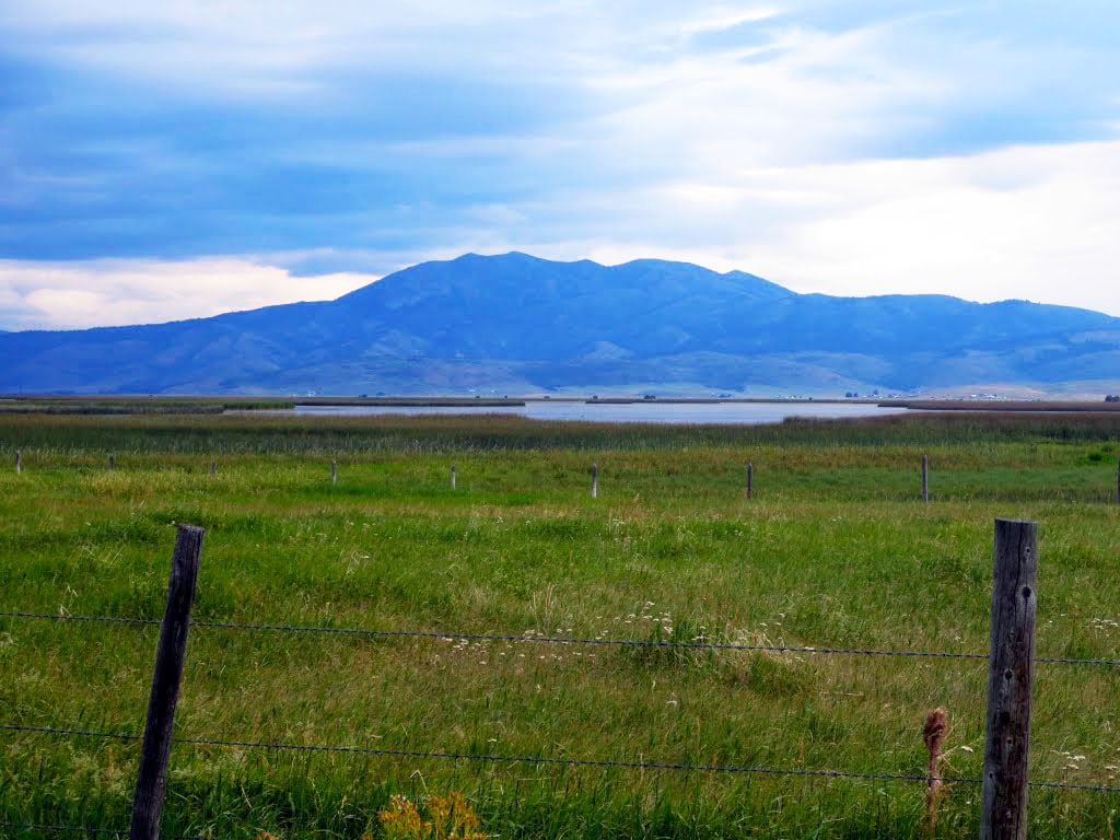
Jesse "Cariboo" Jack Fairchild discovered gold high on this mountain in 1870 and a mining rush from Utah followed. Millions of dollars worth of gold were mined before it ran out. It created an economic boom for the region that went as far south as Salt Lake City. The peak…
View more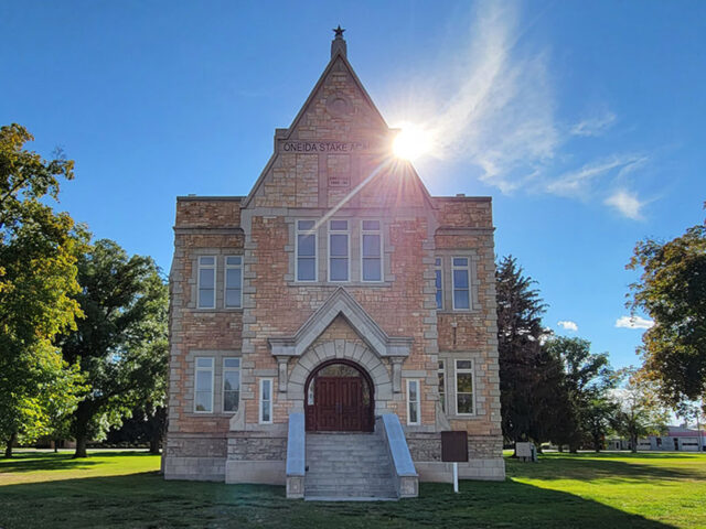
The Academy is a unique 3-story Romanesque stone building, constructed in the early 1890s. It is one of three, out of 35, similar surviving buildings from the days of Mormon Church sponsored education. It was moved from Preston High School to it's current location in 2004.
View more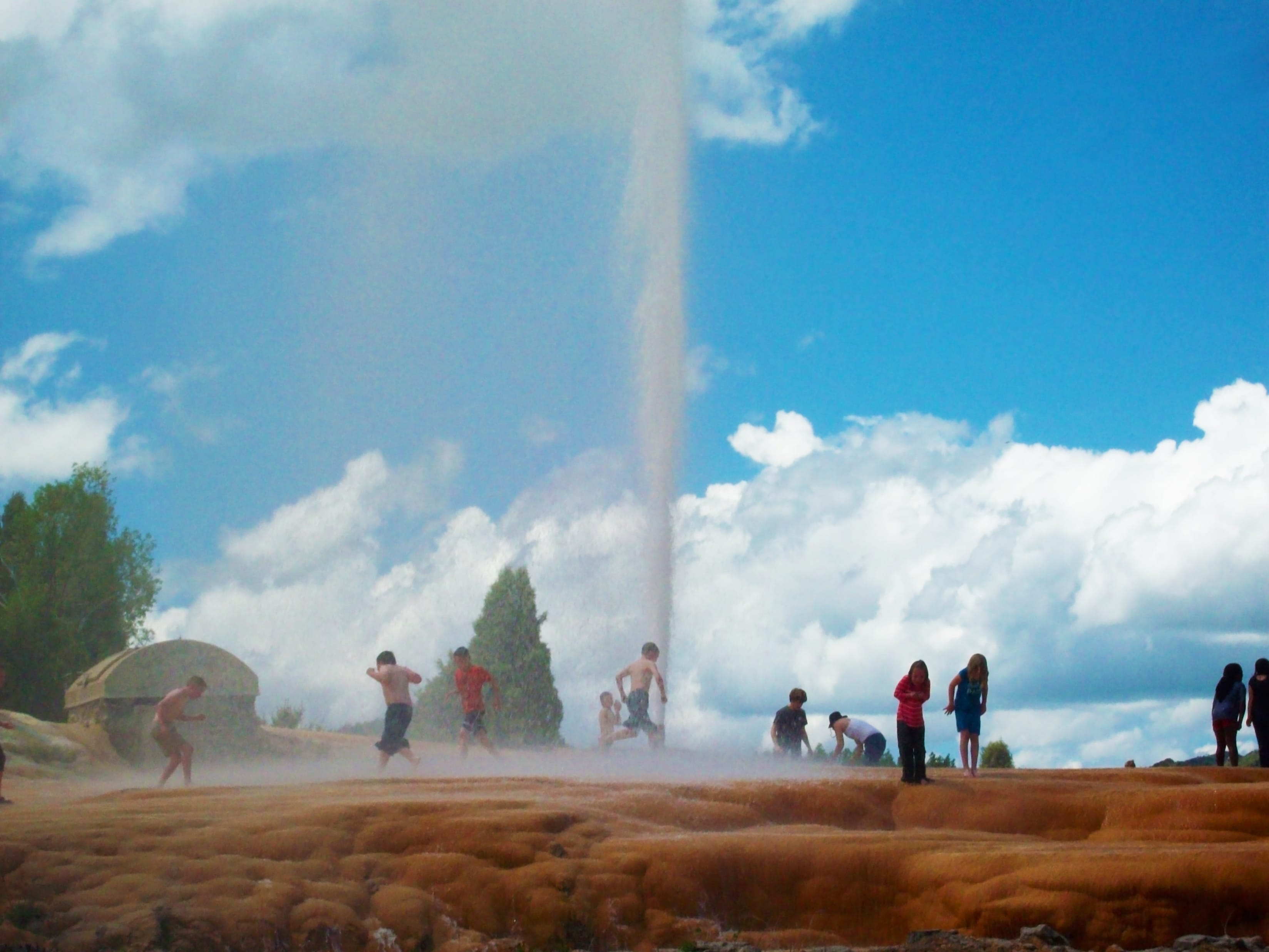
Soda Springs boasts having the world's only captive geyser. On November 30, 1937 in an attempt to find a hot water source for a local swimming pool, a well driller set free the natural geyser at a depth of 317 feet. It is located on Pyramid Spring, a travertine mound described by Fremont in his 1840s expeditions, along with other area springs.
View more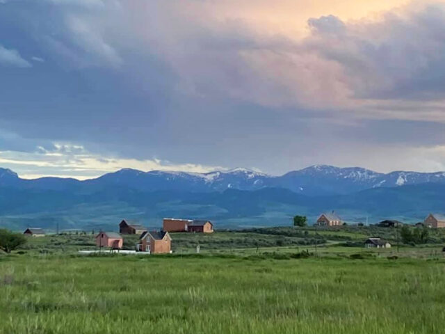
Open in the summer only. CHESTERFIELD is an early Mormon settlement 11 miles north of Bancroft, Idaho. Founded in 1881, it is now unoccupied, but history buffs won’t let it go away. They formed a foundation to refurbish and maintain 27 original structures now on the National Historic Register. Many…
View more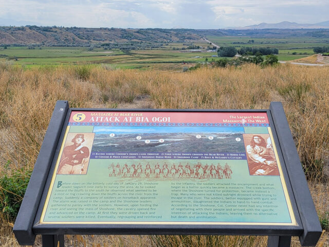
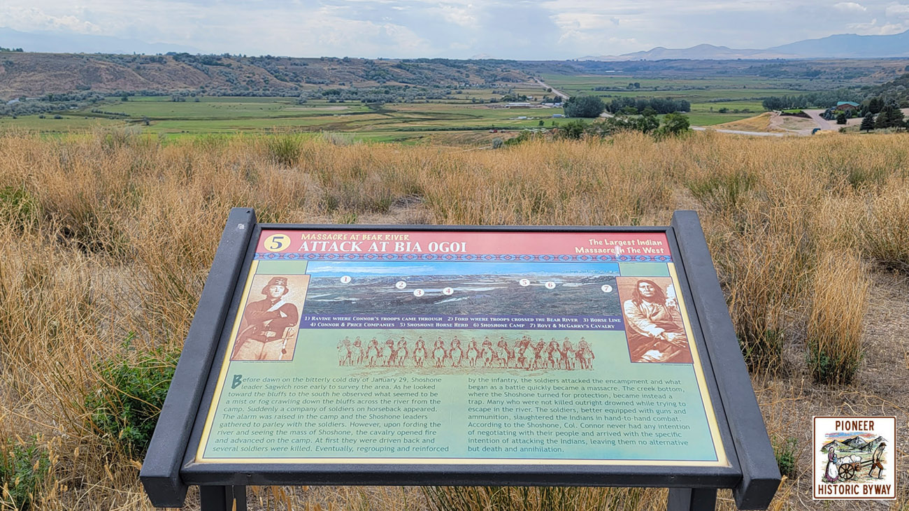
The January 29, 1863 Bear River Massacre of 250 or more Native Americans, by Colonel Patrick Connor and his troops, occurred here. It was designated a National Historic Landmark in 1990. The battle became one of the worst disasters for Native Americans in the west.
View more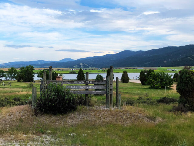
Features a covered picnic area, other picnic sites, and a boat ramp for fishing and boating. Birdwatchers can view pelicans, sea gulls, hawks, geese, and ducks.
View more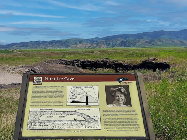
The Cave was formed when basalt lava flowed out of a vent 500 thousand years ago forming a lava tube typical to this type of volcanic activity on the Snake River Plains. It was important to early settlers and native Americans for food storage. John A. Dalton, the original homesteader,…
View more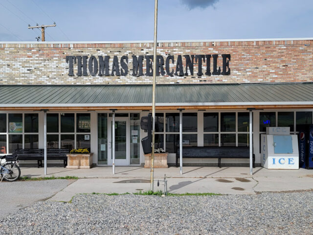
Historic Thomas Mercantile in Swan Lake Idaho has been restored and is now open. They have a convenience store, restaurant, game tables, souvenirs, fresh bakery items and much more! Located on Highway 91 between Preston and Downey. Visit their Facebook page for daily specials and restoration stories and photos.
View more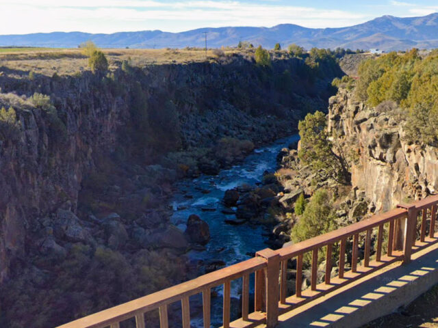
This beautiful gem of the byway could be easily passed or overlooked if travelers aren't already aware of it. The Black Canyon Gorge is just one mile west of Grace and offers display of a basalt lava flow combined with the effects of nature over time. The Bear River formed…
View more
China Hat and China Cap are rhyolite domes that formed around older volcano lava flows. There are many faults located in the area which have had a part in forming these land forms as well as multiple "grabens". This is also a great Bird Watching area. The best bird viewing…
View more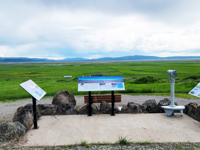
This preserve north of Soda Springs provides habitat for migrating waterfowl such as Sandhill cranes, Franklin's gulls, geese, ducks and hawks.
View more
The buildings are open in the summer only. The oldest continually settled town in Idaho, Franklin was founded in 1860 by Mormon pioneers. Several original buildings stand in the historic district: the Relic Hall, the old ZCMI store, the Hatch House, and others. The Old Yellowstone Route is just outside…
View more